

The Sierra Nevada region is bracing itself for what forecasters describe as “life-threatening blizzard conditions” expected to hit on Friday. These extreme weather conditions are forecasted to bring heavy snowfall, potentially burying parts of northern California and Nevada under thick blankets of snow and creating hazardous road conditions.
The National Weather Service (NWS) has issued a blizzard warning for select areas of Nevada and northern California, effective until Sunday morning, along with a winter storm warning extending until at least Saturday afternoon. Additionally, a high wind warning has been issued for Nevada through Saturday morning.
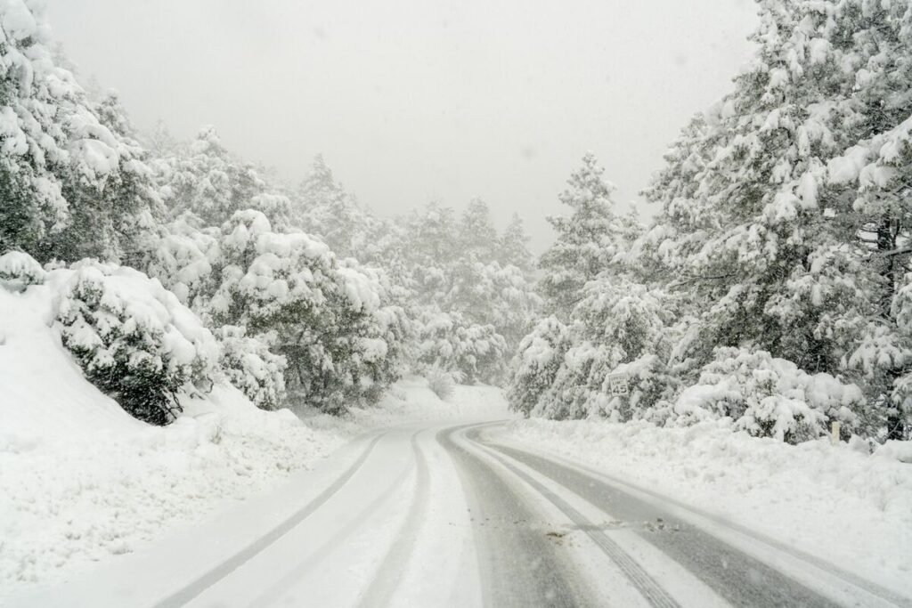
Anticipating the severity of the impending storm, the NWS has urged residents to prepare for treacherous travel conditions, emphasizing the potential for “whiteout blizzard conditions” that could render travel extremely dangerous, if not impossible. Snowfall levels are projected to reach staggering heights, with high elevation areas above 7,000 feet possibly receiving up to 10 feet of snow, while lower elevations, including Lake Tahoe, may see accumulations of up to 6 feet.
In addition to heavy snowfall, forecasters are warning of intense winds gusting at speeds exceeding 115 mph in higher elevations, and up to 70 mph in lower areas. These severe weather conditions are expected to persist throughout the weekend, with the possibility of snow showers lingering into the following week.
The impending storm has prompted widespread concerns about road safety, with the NWS cautioning against travel due to the anticipated hazardous conditions. Mountainous roads, such as Donner Pass and sections of Interstate 5 in northern California, are at risk of closure, while heavy winds could severely impair visibility, posing significant risks to drivers. Authorities are also advising residents to brace for potential power outages, particularly in remote areas where snow accumulation could disrupt utility services.
In response to the looming threat, schools in affected regions have preemptively canceled classes and activities on Friday. Washoe County in Nevada, encompassing Reno, along with the Storey County School District, have suspended all educational activities citing the dangerous road conditions. Similarly, schools in Tahoe City, Truckee, and the Lake Tahoe Unified School District on the California side of the border have opted to close their doors to ensure the safety of students and staff.
Furthermore, the University of Nevada, Reno at Lake Tahoe has suspended all operations and in-person classes for Thursday and Friday in anticipation of the severe weather.
As the storm approaches, concerns about avalanche risks have also been raised, with the Sierra Avalanche Center issuing an avalanche watch for the Central Sierra Nevada mountains. The potential for “high to extreme” avalanche danger has prompted warnings for backcountry travelers to exercise caution and remain vigilant throughout the weekend.
The looming blizzard serves as a stark reminder of the region’s susceptibility to severe winter weather, with historical records recounting devastating avalanches and hazardous conditions. The upcoming storm underscores the importance of preparedness and caution in the face of nature’s unpredictable fury, as communities across the Sierra Nevada region brace themselves for the impending onslaught of snow and wind.